GEOGRAPHIC INFORMATION SYSTEMS (GIS)
What is GIS?
Geographic Information Systems (GIS) technology is typically used to assemble, integrate, analyze, and display all types of spatial or geographic data in a digital format. With this technology you can create intelligent maps which can store and present an enormous amount of information. GIS helps you answer questions and solve problems by looking at your data in a way that is quickly understood and easily shared. GIS is used to provide support for decisions involving environmental studies, geology, engineering, land-use planning, and business marketing.
What can Los Angeles Pierce College do for me?
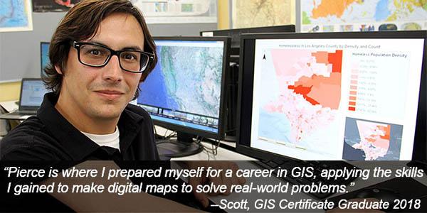
Pierce College offers a Certificate of Achievement and Associate of Arts Degree in GIS. Our GIS program has been designed to provide students with cutting-edge technical knowledge and skills using state-of-the art information technology, such as geographic information systems, satellite imagery and global positioning systems (GPS). Our goal at Pierce College is to provide students with the skills and knowledge necessary for immediate entry-level employment for persons interested in GIS and automated mapping technology. Upon completion of the Certificate or AA degree, students are well-positioned to enter the workforce or advance their GIS careers. Our program also provides the needed upgrading and retraining of current employees in this rapidly expanding technology field. Due to the integrative and interdisciplinary nature of GIS these marketable skills can be applied in a multitude of occupations, such as crime analysis, agriculture, transportation and architecture.
Job Growth Projections
According to the United States Department of Labor, the demand for students with GIS skills will continue to increase in the future. In fact, the Bureau of Labor Statistics states that GIS related jobs are among the fastest-growing new or emerging fields in the United States. A particular highlight is the field of cartography and photogrammetry. Cartographers and photogrammetrists who use GIS technology to create maps are often known as geographic information specialists. Furthermore, the Bureau of Labor Statistics (BLS) reports that jobs in the field of cartography and photogrammetry are expected to grow by approximately 19% between 2016 and 2026 (much faster than average), with a total estimated growth of 2,400 jobs over this same period. BLS additionally estimates that cartography and photogrammetry will be one of the twenty fastest growing occupations in the United States between 2016 and 2026.
Please visit the Pierce College website for the Schedule of Classes and the 2020-21 General Catalog for a complete description of our course offerings. You can also contact Professor Youhanna for more information at @email.
Contact Us
Contact
Dr. Erin Hayes
Department Chair & Faculty Advisor, Cultural Anthropology
Email: @email
Phone: (818) 710-4305
Dr. Brian Pierson
Faculty Advisor, Physical Anthropology
Email: @email
Phone: (818) 710-2876
Adrian Youhanna, GISP
Faculty Advisor, Geography/GIS
Email: @email
Phone: (818) 710-2940
Jason Finley, Ph.D., CCM, GISP
Faculty Advisor, Meteorology
Email: @email
Phone: (818) 610-6555